


Fugro and NMSA improve Papua New Guinea's navigation safety
That will be used to support updated nautical charting and improved coastal zone management.
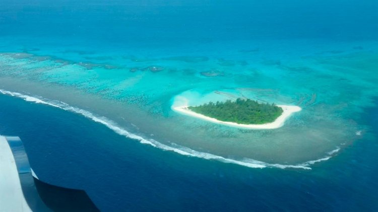
To accomplish the work, the Fugro LADS HD+ Airborne Lidar Bathymetry (ALB) system was deployed with a team of surveyors from both the NMSA and Fugro working in collaboration.
Fugro’s ALB system meets International Hydrographic Organization (IHO) standards with the data now set to be used to update nautical charts. The data was collected safely and with minimal environmental impact on the sensitive reef environment or local marine activity.
Through this Maritime and Waterways Safety Project, Fugro has successfully worked with the NMSA and ADB to help deliver both hydrographic data and training of NMSA staff. The project aims at improving the safety and efficiency of international and national shipping in coastal areas and waterways of Papua New Guinea by improving maritime safety information infrastructure and practices and capacity. Safer maritime activities that improve trade and tourism, as well as information to help manage the environment, will bring direct benefit to PNG’s coastal communities.
Paul M. Unas, the CEO of NMSA was pleased with the successful outcome of the Star Reefs Passage Survey under the Asian Development Bank-funded Maritime and Waterways Safety Project and reaffirmed NMSA's Commitment to ensuring the PNG navigable waterways are adequately surveyed to IHO specifications and nautical charts are updated for the safety of navigation. Mr Unas thanked Fugro for LADS HD & ALB systems performance and capability to meet NMSA expectations in time-demanding environments.


